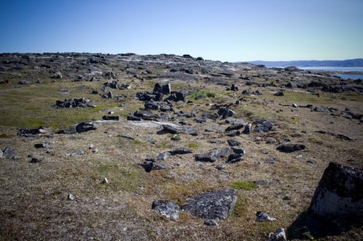
Archaeological research at the Aivirtuuq peninsula, summer 2012
By Frédéric Dessène and Jennifer M. Bracewell
On July 17th, 2012, a team of three archaeologists—Jennifer M. Bracewell (Avataq Cultural Institute, QC), Elspeth Ready (Doctoral Candidate, Stanford University, CA), and Dr Frédéric Dessène (PhD, Universités Paris I and Rome I)—arrived at the peninsula of Aivirtuuq, about 30 kilometers SE of the village of Kangiqsujuaq. They were there to map the Dorset period longhouses at site JiEv4. Two students from Arsaniq High School, Annie Sakiagak and Lydia Ningiuruvik, assisted with the archaeological work. The team was accompanied by two hunter/guides: Sandy Jaaka and Peter Kiatainaq Jr. They were also assisted by Noah Annahataq and Elija Qisiiq for transportation and logistics. The purpose of this preliminary study was to map the longhouses in detail for the first time, as they have not been studied extensively before now.
At the same time as this archaeological project, a series of paleoenvironmental investigations were undertaken. The geomorphology team included Professor Najat Bhiry of Université Laval, and two undergraduate students in geography from Université Laval, Jean-François Bernier and Etienne Brouard. Dominique Marguerie, a researcher with the National Center for Scientific Research in France, conducted botanical research with Claude Paradis, an undergraduate student of forestry at Université Laval. The purpose of these investigations was to gather information on the relationship between people and their ecological and environmental landscape on Aivirtuuq. This field project was organized by the Avataq Cultural Institute as part of the Sivulitta inuusirilaurtangit atuutilaurtanigillu Community-University Research Project (CURA: http://www.avataq.qc.ca/en/ARUC/Le-projet-ARUC), funded by the Social Sciences and Humanities Reseach Council of Canada (SSHRC: http://www.sshrc-crsh.gc.ca/home-accueil-eng.aspx). The Paul Émile Victor Polar Institute also provided funding as part of the LOTECHAIN project, as did the Kativik Regional Government as part of the student employment program.
Over the course of two weeks of fieldwork , we registered close to 4000 topographic readings. This will allow us to make a precise map of the valley where the longhouses of site JiEv4 are found. A 3D analysis of the valley and the Dorset longhouses will be undertaken in the coming months. More to come...


